Friday 28 October 2016

Castaways


the Islas Cies are located at the entrance to the Ria Vigo, we had sailed to and anchored off the Praia de Rodas on the chart below it is fairly central.


The following morning we had visitors, a couple who were also anchored in the bay in a Halberg Rassay called Frejya rowed over, we had bumped into them in Isle de Yeu over 12 months ago!
It is indeed a small world. After a quick catch up we agreed to meet up later in Cangas.


We went ashore as the sun tried to make an appearance and had decided to walk to the summit of the island which has a lighthouse on the top of it called Faro Cies.


The trail led up through the ever present eucalyptus forest and eventually onto the sparse heathland above. There were some interesting rock formations that are a feature of the geology of the islands.


As we wound around the island high above the channel between Islas Cies and Islas San Martino, mainly known as Islas Norte and Islas Sud, (the channel is known as Freu de Porta), the views began to become more expansive.


In the picture above the lighthouse in view is the lower light, our objective was the more spectacular
Faro above. This is reached by a tortuous track that is shown in the photo below, I stole the image from the internet not having access to a helicopter! It shows the path quite nicely.


Many lizards skittered away as we approached along the winding path, again as the tourist ferries had stopped running a few days before we were totally alone apart from Toby and Sara from Frejya, who were somewhere on the island. It was difficult not to imagine that Ernst Blofeld wasnt looking at us from his spectacular lair!


The path was steep and the heat was becoming a bit oppressive, however we soon reached the top and were rewarded by spectacular views, both to the north and south.


It seemed to be a good place to eat our lunch. So we walked down to where the switchback path provided a natural seat.


It would be a fair assumption that we would get a little jaded with spectacular views and wonders of nature. This would be wrong, in the case of this island it is a place suffused with a kind of magic. Lunch was an experience.....


We later dropped down a short cut path to visit the lower lighthouse, this allowed a return path towards a small beach known as the Nossa Senora, visible above Lynnes head below.


The path followed the shore of the channel overlooking the island of San martino and we passed the small fishermans harbour tucked into a small bay.


The rather beautiful little beach, (it would become our favourite) is overlooked by a small effigy of our lady in an inaccessible niche in the rocks on the headland which provides a degree of shelter from the swell and current.


We spent a bit of time just absorbing the atmosphere, the azure sea and crisp white sand and views towards San martino were very special.


Eventually we tore ourselves away from this oasis of peace and tranquility and headed back to Dark Tarn at anchor. We went on the internet and booked ourselves in for a third day at anchor.


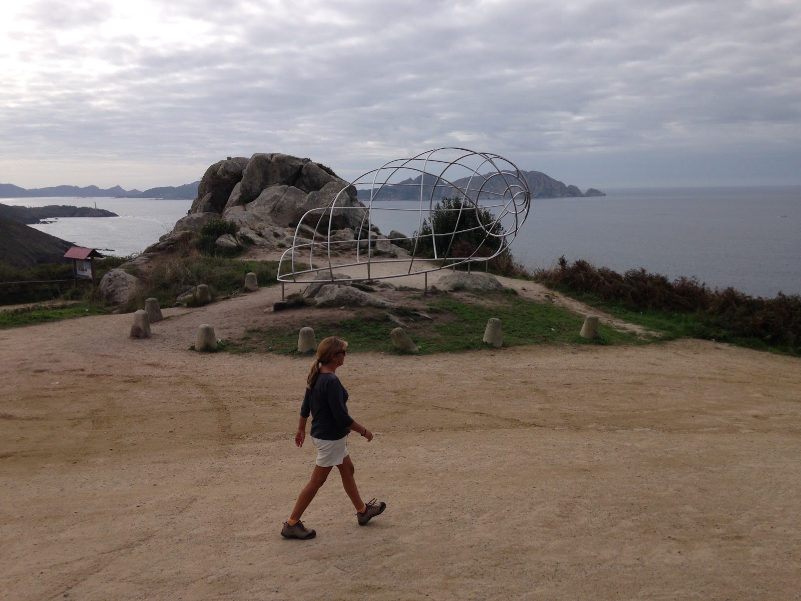
Later we walked to the point overlooking the ensenada de Lago which has a great outcrop of rocks one of which is a perfect chair although i was not successful in persuading Lynne to pose in it for a photograph.


To be fair it was a fair drop down to the crashing waves! I took a series of photographs which turned out to give a nice picture of the view once they had been "stitched" together. The view is towards the


south and the Faro we had visited earlier is on the headland on the right. Dark Tarn is at anchor in the bay on the left. It is easy to see why the Islas Cies are known as barrier islands when you see the difference between east and west sides.
The anchorage remained sheltered and our friends on Frejya left for Bayona in the morning. This left the island to ourselves so we returned to the beach of Nossa Senora and enjoyed a lovely day alone on this beautiful island.


Clothes seemed unnecessary, we swam, eat and enjoyed the sun. The peace was perfect.


We had enjoyed a fabulous three days on the Islas Cies.


It was time to leave our magic island............but we would return.

Thursday 27 October 2016

Islas Cies


We organised our permissions for the visit and armed with our personal printed permissions to navigate and anchor we sailed down the Ria and covered the 6 miles or so to the anchorage at
the Praia das Rodas. We dropped the hook in 7 metres of crystal clear waters and watched the anchor dig into white sand.


This anchorage is really only perfectly safe in westerly winds however the forecast for the next few days was for very light winds so we let out 40 metres of chain in deference to the " super moon " tides that would give us a 4 metre rise and fall.


we had a slight "emergency" on what was one of our smallest trips ever when the echo sounder stopped displaying any depth on the instruments. Lynne sailed the boat while I tore through the boat looking for the problem until after about 20 mins I discovered one of the NMEA "T" connectors that connect the transducers into the NMEA backbone was broken. this was located in a locker in the heads and we had obviously forced too many things into this locker and broke the connector, luckily we had a spare and once replaced the system was working again as we pulled into the lovely bay of Praia das Rodas.


We wasted no time in sorting Dark Tarn and clearing the dinghy for a look ashore.


we decided to walk towards the northern end of the beach as there was an information point near the ferry jetty which was spookily quiet! we very nearly had the island to ourselves.


There is a very well developed network of paths established around the island and we followed an obvious trail through the totally empty campsite area towards the roadway across the neck of the island seperated by a saltwater lagoon.


Both Lynne and I had the same thought, as we crossed the roadway possibly brought on by our recent thinking regarding the big tides we were in the middle of. Namely would this roadway be underwater when we returned? As it turned out we were right to be concerned.....


The island is a national park and is a fantastic haven for wildlife. I think we were very privileged as we had the place to ourselves and the local fauna seemed almost tame.
We discovered the information centre which was obviously closed however there was a handy map to consult.


The majority of the islands are covered in pine and eucalyptus forest. the beaches, of which there are many are superb. Clean white sand, beautiful.


Although the weather was a bit overcast the water was a lovely azure colour and we were almost temted to go for a swim but time was pressing and we knew we needed to get back over the causeway.


It didnt take very long for the magic of this island to begin to sink into us, around every corner was yet another lovely view or vista, the quiet and peace washed in and out with the small waves.


 small noises in the forest turned out to be pine cones falling from the the trees...........


we made our way back towards the dinghy on the beach and by careful timing avoided getting too wet on the causeway. as we sat in the cockpit and the stars came out later that evening we were totally enchanted and were looking forward to exploring the island.

Monte Facha


Monte Facha is a lovely spot dripping in history perched on the windswept and spectacular hammerhead peninsular at the upper head of Ria Vigo. It has been a site of interest to man from prehistory, there are intact remains of a neolithic settlement, a Roman temple and a Napoleonic lookout. We needed to catch a bus to the small village of Donon, this wasnt possible and the nearest we could get was the equally small village of Hio. This then necessitated a 5 kilometre walk along mainly roads until we could get off piste and begin the climb up the hill.
As the weather was sunny and the road wound up through eucalyptus forest this wasn't a great problem.


Once we had reached Donon we located the beginning of the track and began to climb. small lizards scuttered out of the way as we huffed and puffed our way up the well made but rather rocky path.


the half way point was a stand of eucalyptus and a more heathland landscape developed.


Already there were good views towards Islas Ons and Ria Pontevedra.


Soon the lookout came into sight and only when you had gained the summit was it possible to appreciate the neolithic remains, these were excavated in 2008 and are remarkably well preserved being in the form of roundhouses.


we had brought a picnic lunch and settled down to eat admiring the frankly stunning views across to the Ria Vigo and Islas Cies. we settled down on some rocks and enjoyed our sandwiches.


it was difficult to tear ourselves away but we had planned to walk back to Cangas and this would mean a good 12 kilometres of path and we were unsure of at least half of the route.


As I looked over towards the Islas Cies I was again tempted to sail over and spend a few days on the islands as they really looked to be fascinating and extraordinarily beautiful. I knew that the tourist ferries would stop running in a few days so decided that they would be our next goal.


we dropped down to the small village of Donon. There are several paths and cycleways that go out to the end of the headland and the two lighthouses there but we needed to find the way towards the beaches at Barra and Nerga.


We began our search for the path at the car park at Donon which has a tubular shell sculpture.


We dropped down into the dense pine woodland and scrubby heathland that characterizes the country inland of the famous beaches. I will admit to getting slightly lost at least a couple of times but we succeded in finding the very end of the beaches at Nerga.


We had a lukewarm coffee in the one remaining cafe that was open before setting of for the by now well known track and remaining 10 kilometres or so to cangas. The possibilities for walking in the area were looking very good indeed. The lack of a map made life more challenging but it is always fun to discover things by chance.


Monday 24 October 2016

Dry land again


The more time we spend in the Ria Vigo the more beautiful and delightful we find it. The picture below for example is of Lynne and I walking along the coast to Lidl, a local supermarket on the outskirts of town. We choose to walk along the beach shore to get there and then walk back along the road.


it makes going shopping a whole world of difference away from boring.


A nice thing as well, is that there are usually our resident dolphins playing somewhere offshore, or at the very least shoals of fish close in to the beach perfectly visible in the clear water.


Our local exhibition space is in the small chapel of Capela de Hospital, this is just along the seafront from the marina and has a constantly changing series of exibits.


We also continued exploring the coast, walking out to Limens with Ray and Cath.


Of course later on I had to show Lynne the path to Barra I had discovered.


luckily the weather cooperated.


We had lunch on yet another deserted beach, this one however had a swing seat installed!


We made it to Nerga and had a great time. The Eucalyptus woods were heavy with aroma, it was great if you happened to be in the least congested!


I promised to show Lynne the rest of the headland. The Morrazo peninsular was proving fascinating.